this can’t be an accurate or reasonably accurate depiction, these are two completely different storms in a different category after all.
This is like me comparing the joplin tornado to the el reno tornado.
(for those that don’t know the joplin tornado was an extremely erratic EF/F 5 tornado that was incredibly strong and just sort of showed up and then lingered over a particular area causing immense destruction, whereas el reno was a massive, very powerful tornado, that was collectively rated to be about an EF/F 3 i believe, although the core itself, and numerous shenanigans it pulled including sub vorticies or whatever the correct term is were much stronger, causing strong localized damage)
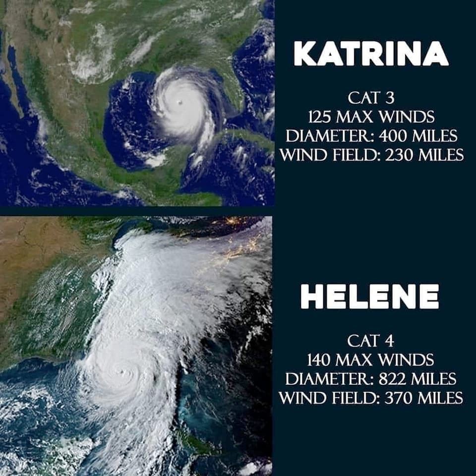
The different categories are the point. What they’re missing though is Helene was much closer to a category 5. It’s winds were 15 mph short of that category and the storm tail you can see in the above photo is characteristic of category 5 Hurricanes. That in and of itself isn’t a big deal. The big deal is that it’s the second storm at this strength this year. The first one stayed coastal where they’re used to all that rain.
What the picture is basically saying is Katrina was a warning shot. An actual Category 5 with winds well past 157 mph is going to hit the wrong spot and we’re all going to regret not taking climate change seriously.


this can’t be an accurate or reasonably accurate depiction, these are two completely different storms in a different category after all.
This is like me comparing the joplin tornado to the el reno tornado.
(for those that don’t know the joplin tornado was an extremely erratic EF/F 5 tornado that was incredibly strong and just sort of showed up and then lingered over a particular area causing immense destruction, whereas el reno was a massive, very powerful tornado, that was collectively rated to be about an EF/F 3 i believe, although the core itself, and numerous shenanigans it pulled including sub vorticies or whatever the correct term is were much stronger, causing strong localized damage)
The different categories are the point. What they’re missing though is Helene was much closer to a category 5. It’s winds were 15 mph short of that category and the storm tail you can see in the above photo is characteristic of category 5 Hurricanes. That in and of itself isn’t a big deal. The big deal is that it’s the second storm at this strength this year. The first one stayed coastal where they’re used to all that rain.
What the picture is basically saying is Katrina was a warning shot. An actual Category 5 with winds well past 157 mph is going to hit the wrong spot and we’re all going to regret not taking climate change seriously.
What do you mean? This shows the differences between the two.